
Hiking in Arches National Park
There are lots of hiking opportunities in Arches National Park, whether you are looking for short, easy walks, or more strenuous, longer hikes. Trails provide access to outstanding viewpoints and arches not visible from the road. In some cases, trails travel under arches, affording quite a unique perspective on the park’s namesake features.
Easy Trails

Balanced Rock
0.3 miles (0.5 km), 20 minutes
The short, relatively flat trail allows you to see Balanced Rock from all sides as it loops around the base of the formation. Part of the trail is paved and accessible to wheelchairs.

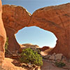
The Windows
1 mile (1.6 km), 45 minutes
A gentle climb up a gravel trail leads to North Window, South Window, and Turret Arch. Return to the parking lot via the same trail, or take the slightly longer primitive trail around the Windows by starting at South Window viewpoint. First 100 yards may be accessible to wheelchairs with assistance.

Double Arch
0.5 mile (0.8 km), 20 minutes
You won’t believe how massive Double Arch is close up! A relatively flat, gravel-surface leads to the base of two giant arch spans which are joined at one end. May be accessible to wheelchairs with assistance.

Delicate Arch Viewpoints
100 yards (91 m), 10 minutes
or 0.5 miles (0.8 km), 30 minutes
Lower viewpoint: wheelchair-accessible view of arch at a distance.
Upper viewpoint: Moderately strenuous hiking trail climbs 0.5 mile (0.8 km) toward Delicate Arch, ending at a viewpoint separated from the arch by a steep canyon. You can’t reach Delicate Arch on this trail; to hike to Delicate Arch, start from Wolfe Ranch.

Sand Dune Arch
0.3 miles (0.5 km), 20 minutes
This short hike is easy for all ages. Cross deep sand to a secluded arch among fins of rock.
Do not climb or jump off the arch.
Broken Arch Loop
2 miles (3.2 km), 60 minutes
From the trailhead at the Sand Dune Arch parking area, the trail crosses a large meadow to the arch and continues to the campground. From there, the trail leads through fins with sand dunes and slickrock. The northern part of the loop includes some moderate scrambling.

Skyline Arch
0.4 miles (0.6 km),10-20 minutes
Park at the Skyline Arch parking area. Enjoy a short hike on a flat, well-defined trail. Remember, geology happens! On a cold night in November 1940, a large chunk fell out of the arch, instantly doubling the size of its opening.

Landscape Arch
1.6 miles (2.6 km), 50 minutes
Park at the Devils Garden trailhead. A relatively flat, gravel-surfaced trail leads to a spectacular ribbon of rock, whose span is more than a football field in length.
Some steep slopes may be accessible to wheelchairs with assistance.
Short side trips lead to Tunnel and Pine Tree arches. A trail guide is available at trailhead.
After Landscape Arch, the Devils Garden trail becomes difficult, with rock scrambling, narrow ledges, and exposure to heights.
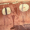
Courthouse Wash Rock Art
1 mile (1.6 km), 40 minutes
Park at the Lower Courthouse Wash parking area, 0.5 miles (0.8 km) north of the Colorado River on the right side of US 191. A short walk south across the Courthouse Wash bridge and a brief climb leads to a prehistoric rock art panel (at the base of the cliffs, facing west).
Rock art is often found at crossroads and near waterways.
In 1980, this ancient rock art was vandalized. The National Park Service was able to partially restore the panel.
Moderate Trails

Park Avenue
2 miles (3.2 km), 1.5 hours, 320 feet (98 m) elevation change
From Park Avenue parking area, the trail descends steeply into a spectacular canyon and continues down the wash to Courthouse Towers. If you have a shuttle driver, you can begin at one point and be picked up at the other. For roundtrip hiking, retrace your steps along the trail rather than walking along the park road.
Difficult Trails

Tower Arch
3.4 miles (5.5 km), 2.5 hours
Trail climbs a steep, short rock wall, cuts across a valley and then meanders through sandstone fins and sand dunes. An alternate, shorter trail (0.3 mile [0.5 km] one way), begins at the end of the four-wheel-drive road on the west side of Tower Arch. Unpaved roads wash out quickly in rainstorms; check road conditions before heading out.

Delicate Arch
3 miles (4.8 km), 2.5 hours, 480 feet (146 m)
Open slickrock with no shade. The first half mile is a well defined trail. Follow the rock cairns. The trail climbs steadily and levels out toward the top of this rock face. Just before you get to Delicate Arch, the trail traverses a narrow rock ledge for about 200 yards (183 m). Take at least 2 quarts (2 L) of water per person.

Double O Arch
4.5 miles (6.8 km), 2.5 hours
Beyond Landscape Arch (listed above), the trail is more challenging as it climbs over sandstone slabs. Footing is rocky; there are narrow ledges with exposure to heights.
Spur trails lead to Partition and Navajo arches.
Dark Angel is 0.5 miles (0.8 km) farther. Trail guide available at trailhead.

Primitive Trail at Devils Garden
7.2 miles (11.6 km), 4 hours
The Primitive Trail is an alternative route to or from Double O Arch. It involves narrow ledges, uneven surface hiking and scrambling on slickrock.
Not recommended when rock is wet or snowy, or for those uncomfortable with heights or exposure.
Trail guide available at trailhead.
Fiery Furnace
No trail
The Fiery Furnace is a labyrinth of narrow sandstone canyons that requires agility to explore. To enter the Fiery Furnace, you must accompany a ranger-guided hike or obtain a day-use permit at the visitor center.
There are small markers for one counter-clockwise route in the Fiery Furnace, but there are many other possible paths, and getting lost is a real possibility. GPS units do not work well due to the towering sandstone walls.
We encourage you to accompany a ranger—both for your own safety and to reduce impacts on the area. You can make a reservation for the Fiery Furnace ranger-led hike from May 1 – September 28, 2019 at Recreation.gov. For more information about the Fiery Furnace, visit the Arches National Park website on NPS.gov.
How to Protect the Park
Watch Your Step
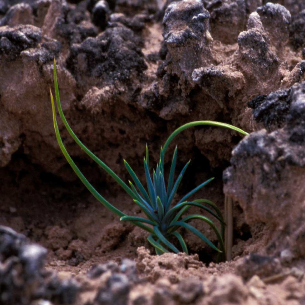
Avoid walking on the dark, bumpy biological soil crusts.
Soil crust is made up of living organisms that help control erosion and hold moisture.
Walk only on trails, rock or in sandy washes.
Keep all vehicles on designated roads.
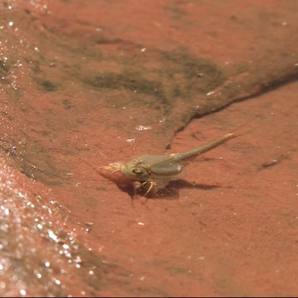
Protect Ephemeral Pools (Potholes)
Sandstone basins are home to a variety of life. Tiny organisms depend on the water in these shallow pools.
To protect these life forms, please do not swim, bathe, or drink the water in desert potholes, and do not walk through dry ones.
Keep Off the Arches
To promote visitor safety and the opportunity for others to view natural features undisturbed, climbing, scrambling, walking or standing upon, or rappelling off any arch is prohibited in the park.
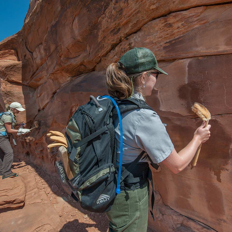
No Graffiti Please
No one likes to see graffiti in a national park. Carving, scratching, chalking, or any type of marking is illegal and unsightly.
If you see someone marking on the rocks, please report it to a ranger.
Your purchases and donations support education and research on the public lands of Southeastern Utah!

Arches & Canyonlands Postcard Book
6.99 (15% off for members)

Arches Benchmark Keychain
7.99 (15% off for members)

Arches Delicate Arch Crew Socks
10.99 (15% off for members)

Arches Delicate Arch Night Crew Socks - Men's
16.99 (15% off for members)

Arches Delicate Arch Night Crew Socks- Women's
14.99 (15% off for members)