Things to Do
Moab AreaThere are many ways to have fun and enjoy the public lands of the Moab area… and although Arches and Canyonlands are spectacular, there is so much to do here beyond the national parks!
Hiking, mountain biking, auto-touring, 4-wheeling, ATV/UTV riding, and rafting the Colorado River are just some of the recreational opportunities available. You can also discover dinosaur tracks, stargaze under Moab’s incredible dark skies, and see ancient rock art.
Moab Information Center
If you have questions or need help deciding what to see and do, stop by the Moab Information Center.
Our knowledgeable staff will help you make the most of your visit!
Hiking
Bureau of Land Management (BLM)
There are 1.8 million acres of public lands surrounding Moab that are managed by the Bureau of Land Management (BLM). Nearly 3 million visitors a year come to enjoy all kinds of recreation, including hiking. BLM developed trails offer opportunities to explore this amazing area beyond the parks, and without the crowds. Here is a link to the BLM Hiking Guide.
Recommended: Latitude 40’s Moab West map and Moab Hiking Trails.
La Sal Mountains, Manti-La Sal National Forest
(Roads and trails may not be open until May or June or after November 1st because of snow. Call the Moab Ranger district for current conditions: 435-259-7155.)
Hiking trails on the west face of the La Sal Mountains offer a diversity of vegetation and elevation differences. In summer, the La Sals offer a cool respite from the heat in the Moab Valley. Fields of wild iris bloom in the spring. High mountain lakes shimmer, cool and inviiting in summer. Fall brings golden aspens and red gambel oak leaves. Wildlife such as elk, mule deer, bobcat, black bear, mountain lion, and grouse call the La Sals home. Leash your pet while hiking to protect it and the wildlife you may encounter.
- Warner Lake to Oowah Lake Trail: Trail length: 1 mile (1.6 km)
- Miners Basin to Warner Lake Trail: Trail length: 2 miles (3.2 km)
- Squaw Springs Trail: Trail length: 4.1 miles (6.6 km)
For more La Sal Mountain hiking trails, visit the Manti-La Sal National Forest webpage. Contact the Moab Ranger District if you have questions: (435) 259-7155.
Recommended: The Manti-La Sal map and La Sal Hiking Guide.
Biking
Mountain Biking
With nearly 100 trails, Moab’s title as a mountain biking mecca is well deserved. You’ll find trails for every skill level that twist and turn through the spectacular landscapes from the La Sal Mountains to the red rock desert outside of Moab to mesa tops with jaw-dropping views. Here is a link to mountain bike trails: Discover Moab’s Moab Mountain Biking Trail Guide.
Recommended: Latitude 40’s Moab Singletrack map, Mountain Biking Moab Pocket Guide.
Road Biking
There are lots of amazing skinny tire rides in the Moab area. Imagine cycling along the Colorado River, on the mesa into Canyonlands National Park, or up the La Sal Loop Road for fantastic views of the area. Visit Discover Moab’s Road Biking webpage for details. Make sure to carry lots of water and high-energy foods with you on any of these remote routes.
Auto Touring
La Sal Loop Road
This National Forest Scenic Drive is a 63.3 mile (102 km) loop that begins and ends in Moab. Allow 3 hours. The road is paved and suitable for passenger vehicles. It travels up to and along the western flank of the La Sal Mountains treating you to fantastic views of the peaks, forested scenery, and expansive views of the area. After descending into colorful Castle Valley, the route travels along the Colorado River back to Moab. In winter and spring, check with the Moab Information Center in downtown Moab for current road conditions. There are no services on the La Sal Loop Road. Download a map of the Loop Road (.pdf) and visit the Manti-La Sal Website for more information.
Recommended: Latitude 40’s Moab East map
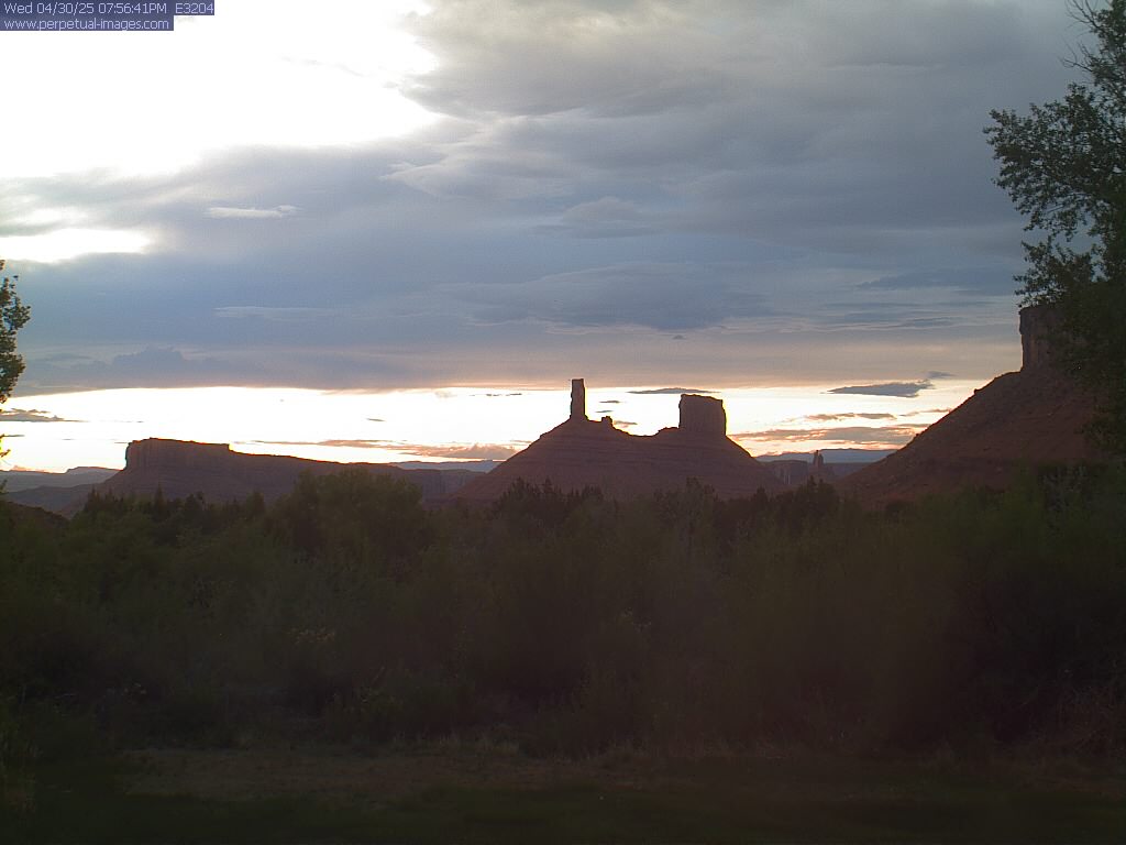
Colorado River Scenic Byway (SR 128)
64 miles (102 km) round trip to Dewey Bridge and back to Moab. Allow 2 hours.
From Moab, drive north on Highway 191 about 2 miles (3.2 km) to the intersection of SR 128. Turn right onto SR 128. This scenic route follows the Colorado River north through its spectacular canyon gorge. After about 15 miles (24 km), the canyon opens up to wild west views of buttes and mesas near Castle Valley. At 24.7 miles (39.8 km) look for the spires of Fisher Towers on the right. Continue on to Dewey Bridge, where you can see the remains of the historic bridge that unfortunately burned in 2008 when a child playing with matches set fire to the area. The scenic part of the road ends here. Turn around and return to Moab the way you came. Travel this route later in the day to catch the scenery aglow near Fisher Towers and Castle Valley as the sun sets.
Potash Road – Lower Colorado Scenic Byway (SR 279)
36 miles round trip (57 km). Allow 1.5 hours. Drive north from Moab on Highway 191 about 4 miles (6.4 km) to the left turn onto SR 279 (Potash Road). After about 2.7 miles (4.3 km) this scenic route turns into the portal of the Colorado River gorge. Enjoy the beautiful views of the river. There are three BLM campgrounds along the road (download the BLM Campground list and map, .pdf). Along the route you’ll pass “Wall Street”, a favorite climbing area. Drive another .75 miles (1.2 km) to a marked pull off on the left. Stop to see the magnificent ancient rock art on the cliff walls. Further down the road, at about the 6-mile mark (9.6 km), you’ll see a sign for the Poison Spider dinosaur tracks. The Corona Arch Trailhead is at the 10-mile mark (16 km) if you are in the mood for a great hike. Continue on to the 17.5 mile mark (28 km) to see Jug Handle Arch on the right. Return to Moab the way you came.
Motorized Routes
There are thousands of miles of 4-wheel drive routes on public land in the Moab area to explore and enjoy. ATVs, UTVs, and dirt bikes are welcome on any 4-wheel drive routes near Moab, except within Arches or Canyonlands National Parks. Whatever your mode of motorized transporation, always stay on the route. Visit Discover Moab’s 4-Wheeling Trails and ATV Trails and UTV Riding webpages for route information.
Recommended: Moab Backroads & 4-Wheel Drive Trails and ATV Trails Guide, Moab, UT.
Stargazing
The parks and public lands around Moab have some of the darkest skies in the U.S. Here you can see the Milky Way pour across the night sky, and gaze at countless stars. Visit our stargazing web page to get tips on how and where to see the stars.
Tips: Bring a red light flashlight (or cover a regular flashlight with red cellophane) to protect you night vision), a folding chair or a blanket to sit on, and warm clothes. The farther you drive away from the lights of Moab, the darker the sky will be.
Recommended: The Night Sky Pocket Guide
Rock Art
Rock art created by ancient people adorn many rocks and cliff faces throughout the Moab area. Petroglyphs were pecked or abraded into the rock and pictographs were painted on the stone.
Please respect the sacredness of these sites to today’s native peoples. Protect rock art by not touching it. Never carve graffiti into the rock. Do not disturb or collect artifacts or features at rock art sites. Take photos. Appreciate them, but leave them in place.
A Sampling of Moab’s Rock Art Sites
Golf Course (Moab Man)
From Moab, drive south on Highway 191 approximately 4 miles. Turn left onto Spanish Trail Road at the Shell gas station. Follow Spanish Trail Road to a traffic circle. Take the 2nd road (Westwater). Just past the fire station on the left, bear right to follow Westwater Drive. Proceed .5 miles (.8 km) to a small pullout on the left-hand side of the road (please do not block the private driveway). Look for the famous Moab Man petroglyph – he’s the one with the ear bobs!
Potash Road Rock Art
The cliffs along a portion of the Potash Road (SR 279) offer a chance to see a lot of fascinating rock art in one place. To get there, drive north from Moab on Highway 191 about 4 miles (6.4 km) to the left turn onto SR 279 (Potash Road). Drive SR 279 about 5 miles and look for a rock art sign and parking pullout on the left. Park here. Look for the petroglyphs on the cliff wall, up about 15 -20 ft.(4.5 m). Watch for traffic as this road can be fairly busy. Continue to another sign and pullout a little further down the road. Look here for the large bear petroglyph incised into the rock.
Sego Canyon Rock Art Interpretive Site
Sego is about 40 miles from Moab, but well worth the drive. You will see rock art there from 3 distinct cultures, Barrier Canyon Style (red ghostly figures, pictographs), Fremont (petroglyphs), and Ute (white and red pictographs), representing at least 2,000 years that this area has been significant to Native Americans. To get there, drive north from Moab on Highway 191 for 30 miles. Get on 1-70 East and drive about 5 miles. Take Exit 187 off I-70, drive through the small town of Thompson, and continue approximately 3 miles to the Sego Canyon site. The road is paved most of the way. The short portion of the road that is not paved is well-graded. Major rock art panels are visible from the road. There is a parking lot, vault toilet and picnic table at the site.
Get CNHA’s Moab Rock Art Driving Tour book for more sites and information.
Dinosaur Tracks
Mill Canyon Tracksite Interpretive Trail
This is one of the largest and most diverse tracksites in the U.S. The self-guided .5 mile (.8 km) walk has interpretive panels along the trail and boardwalk. Each panel describes unique dinosaur tracks that can be seen at this site, including 8 different types of dinosaurs, and a crocodile resting trace. From Moab, drive 15 miles (24 km) north on Hwy 191. Look for the Mill Canyon sign and turn left onto the dirt road. Follow signs for the next 0.8 miles (1.3 km) to the parking lot for the trail, located to the right in the rock lined parking area.
Poison Spider Dinosaur Tracks
Two rock slabs with dinosaur tracks are visible from the parking lot, one at the base of the cliffs and another halfway down the slope, just above the cliff that drops down to the road. The lower of these slabs contains the tracks of at least 10 different meat-eating dinosaurs. From Moab, drive north on Hwy 191 for 5.9 miles (9.4 km) and turn left on Hwy 279 (Potash Road). Continue 6 miles to the Poison Spider trailhead. Parking lot is up on the top of the hill.
Bull Canyon Dinosaur Tracksite
This tracksite is in the Manti-La Sal National Forest. It features tracks made by large meat-eating theropod (three-toed) dinosaurs made about 165 million years ago. Part of this short hiking-only trail meanders through scrub oaks and pines. Another section goes to an overlook with a steep drop-off. Please be careful and keep track of children. From Moab, drive north on U.S.191 about 2 miles (3.2 km) to the intersection of SR 128. Turn right onto SR 128 and drive 15.5 miles (25 km) to the signed Castle Valley turn off. Turn right and drive 10.7 miles (17.2km). Remain straight on the Gateway Road, FR0207 (don’t take the right turn onto La Sal Loop Rd) for another 5.4 miles (8.7 km) to a parking lot on the left, just before the pavement ends.
Recommended: Moab Dinosaur Tracks will guide you to several track sites and has information about each one.
Colorado and Green Rivers
The Colorado and Green Rivers near Moab offer water recreation for every skill level. Go white-water rafting on the Colorado River or float down the calm Green River. Get a thrilling ride in a jet boat or enjoy an evening boat ride and light show on the river, or stand-up paddle board or kayak. Commercial outfitters in Moab offer lots of different options, or you can self-guide your adventure. Just remember that all river recreation requires you to wear life vest.
Visit our Colorado and Green Rivers webpage for more information.
For information about outfitters, visit Discover Moab’s Guides Outfitters and Services web page. Recommended: Canyonlands River Guide.
Sample Itineraries
In 2 hours you can:
- Drive to the Windows in Arches National Park and see some of the park’s largest arches. Stop at Courthouse Towers and Park Avenue viewpoints, -or-
- Drive to Delicate Arch Viewpoint in Arches National Park and see the world’s most famous arch from a distance. Stop at Wolfe Ranch on your way back, and imagine homesteading here in the late 1800s. -Or-
- Drive the spectacular Colorado River corridor to Hittle Bottom on Hwy. 128 and back to Moab, -or-
- Visit Dead Horse Point State Park (late afternoon has the best light).
In 3 hours:
- Drive the entire Arches National Park road, spending 10 minutes at each viewpoint, -or
- Visit Canyonlands National Park, Island in the Sky. Drive to Grand View Point or Green River Overlook. Hike the easy 1/2 mile (0.8 km) trail to Mesa Arch. -Or-
- Drive the scenic La Sal Mountain Loop Road (portions of this road may close due to snow in winter)
In 4 hours:
- Drive through Arches National Park and hike the Devils Garden Trail as far as Landscape Arch. Explore the short side trails to Tunnel and Pine Tree arches. Hike the Delicate Arch Viewpoint trail to see Delicate Arch from a distance. Visit the Windows, Courthouse Towers and Park Avenue Viewpoints. -Or-
- Visit Canyonlands, Island in the Sky: Drive to the Grand View Viewpoint and hike the Grand View Point Trail. Drive to the Green River Viewpoint. Hike the Mesa Arch trail. -Or-
- Drive the La Sal Mountain Loop Road. Visit the Film and Western Heritage Museum at Red Cliffs Lodge.
In 1 day:
- Drive the entire Arches National Park road, stopping at the Windows, Wolfe Ranch, and Delicate Arch Viewpoint. Hike the Devils Garden Trail to Landscape Arch. -And-
- Visit Canyonlands National Park, Island in the Sky – Drive to all viewpoints along the scenic road. Hike to Mesa Arch hike. Go to Dead Horse Point State Park. -Or-
- Raft the Colorado or take a 4X4 tour in morning; Do a quick tour of Arches or Canyonlands National Park in the afternoon.
In 2 days:
- Tour both Arches and Canyonland National Parks.
- Hike the Corona Arch Trail. View the rock art along RT 279 in the morning. In the afternoon, drive scenic Rt. 128 along the Colorado River to Hittle Bottom. Hike the Grandstaff Canyon Trail along the way. Visit the Film and Western Heritage Museum at Red Cliffs Lodge.
In 3 days:
- Visit Dead Horse Point State Park and Canyonlands, Island in the Sky.
- Bike a couple of the Moab Brand Area mountain bike trails. Visit the Mill Canyon Dinosaur Tracksite. Go to Arches National Park to end the day.
Your purchases and donations support education and research on the public lands of Southeastern Utah!

2025 Canyon Country Calendar
12.99 (15% off for members)

ATV Trails Guide, Moab, UT
24.95 (15% off for members)

Last of the Robbers Roost Outlaws - Moab's Bill Tibbetts
15.99 (15% off for members)
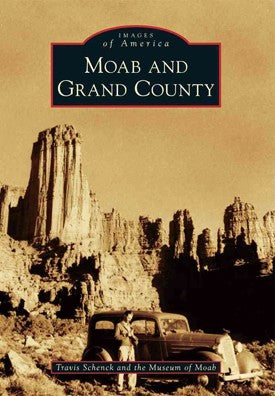
Moab and Grand County (Images of America series)
24.99 (15% off for members)

Moab Area Rock Art DVD
9.99 (15% off for members)